The US state of Illinois is one of the most noteworthy states in the USA. It is only the 25th largest state in terms of land area, but it is the fifth most populous state in the union. The largest city of Chicago, found on the shore of Lake Michigan, is also the third largest city in the USA.
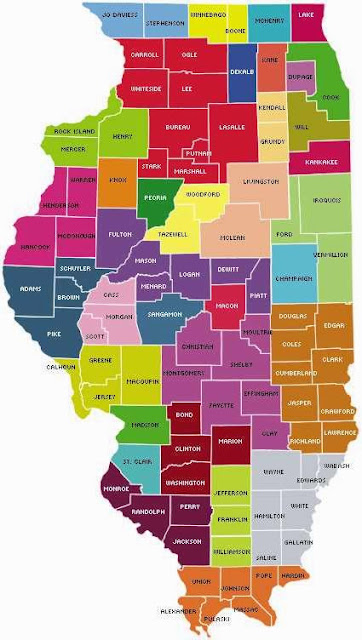
Believe it or not, there are 102 counties in the state of Illinois. Some of them are named after early leaders of Illinois, and others are named after native American tribes. The most populous county is Cook County, which is where Chicago is located (as you may have guessed). It has a population of 5,246,546. The least populous county is the rural county of Hardin, with an overwhelmingly massive population of 4,129! :)
An interesting fun fact: Illinois is the only state to have two different counties named after the same person! That person is DeWitt Clinton, after whom DeWitt County and Clinton County were named. How`s that for having your legacy live on?
Here are some maps of Illinois counties:
Illinois is a great place so I hope you have a chance to visit, and I hope these maps are helpful in getting to know the state and its counties.
LIKE, SHARE, or TWEET this page if you found it useful! Thanks! :)


.png)
0 Comments