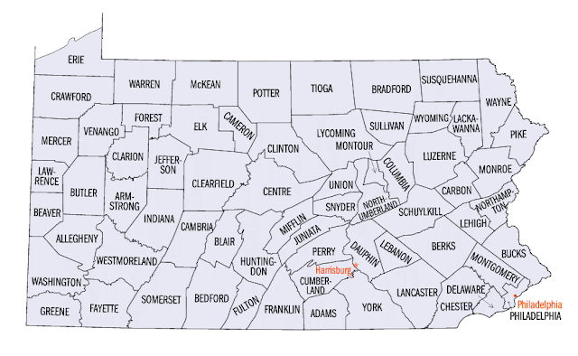
If you need a map of Pennsylvania counties, then look down below and click on the maps.
Because of Pennsylvania`s location in the Northeastern United States, next to New Jersey and New York, it is often lost in the shadow of New York. But the truth is that Pennsylvania is a fascinating and important state in its own right. It is the home state of Philadelphia and Pittsburgh, two major cities you are probably familiar with, and it is the sixth most populous state in the United States. It is only the 33rd largest in terms of size, though - which means that its population density is fairly (actually, ninth across the country).
Much of the population of Pennsylvania is found in the southeastern counties. The most populous county is Philadelphia county with 1,548,647. Number 2 is Allegheny County, which is not in the southeast, it is in the west and is the home of Pittsburgh. It has a population of 1,229,912. The next few are all southeastern counties:
3) Montgomery County - 808, 946 people.
4) Bucks County - 626,377
5) Delaware County (not to be confused with the state of Delaware) - 560,699
6) Lancaster County - 526,436
7) Chester County - 506,190
8) York County - 437,411
9) Berks County - 412,948
Then number 10, Westmoreland County, is in the western part of the state next to Allegheny County. It has a population of 363,263.
Here are some Pennsylvania county maps for your reference:
Pennsylvania is definitely where the action`s at! Don`t let anyone tell you that it`s second to New York. I hope you get the chance to visit, and I hope the above maps are helpful.
LIKE, SHARE, or TWEET this page if you found it useful! ;) Thanks!


.png)
0 Comments