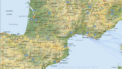
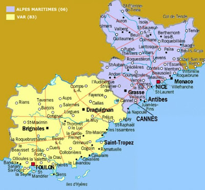
Down below you can find a useful South of France Map for your reference and travels
The South of France, which is also referred to as Southern France, is known to the French people as "le Midi". The region includes all of the administrative regions of France that border Spain, The Mediterranean Sea, Italy, and the Atlantic Ocean south of Gironde. In precise terms, this includes the administrative regions of Aquitaine, Midi-Pyrenees, Languedoc-Roussillon, Provenc-Alpes-Cote d`Azur, and Corsica, as well as the Southern parts of Rhone-Alpes.
The South of France is well-known for its beautiful scenery, architecture, and Mediterranean climate. It is home to the world-renowned coastal cities of Nice and Cannes. The holiday season extends from May to October, with April and November also sometimes enjoying warm temperatures. The late fall and winter are mild, with daytime temperatures averaging 13.4 degrees. Not a tropical climate, but certainly a lovely and comfortable one, with long, beautiful summers.


The Southern France map below is basic and simple which makes it easy to print out without using much ink.

Hopefully you found a good South of France map for your reference and perusal.
The South of France, which is also referred to as Southern France, is known to the French people as "le Midi". The region includes all of the administrative regions of France that border Spain, The Mediterranean Sea, Italy, and the Atlantic Ocean south of Gironde. In precise terms, this includes the administrative regions of Aquitaine, Midi-Pyrenees, Languedoc-Roussillon, Provenc-Alpes-Cote d`Azur, and Corsica, as well as the Southern parts of Rhone-Alpes.
The South of France is well-known for its beautiful scenery, architecture, and Mediterranean climate. It is home to the world-renowned coastal cities of Nice and Cannes. The holiday season extends from May to October, with April and November also sometimes enjoying warm temperatures. The late fall and winter are mild, with daytime temperatures averaging 13.4 degrees. Not a tropical climate, but certainly a lovely and comfortable one, with long, beautiful summers.


The Southern France map below is basic and simple which makes it easy to print out without using much ink.

Hopefully you found a good South of France map for your reference and perusal.


.png)
0 Comments