If you need an Arabian Sea map, you can find one down below.
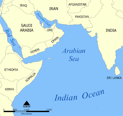
The Arabian Sea, known as Bahr al Arab in Arabic, is a northern section of the Indian Ocean that lies between the Arabian peninsula to its west, India to the east, Pakistan and Iran to the north, and part of the Horn of Africa to the southwest. There are seven countries that have coastal areas on the Arabian Sea, specifically: Somalia, Djibouti, Yemen, Oman, Iran, Pakistan, India, and Maldives.
The total area of water that the sea takes up (in surface area rather than in volume) is 3,862,000 km2 - or 1,491,130 sq miles. The sea actually has two braches, one being the Gulf of Aden; the other, the Gulf of Oman, which connects with the Persian Gulf. On the Indian coast, the gulfs of Cambay and Kutch also exist.
This Arabian Sea map shows the sea itself as well as the surrounding countries in the Middle East and South Asia.
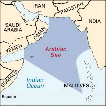
In this Arabian Sea map you can see the precise boundaries of where the sea is demarcated.


.png)

0 Comments