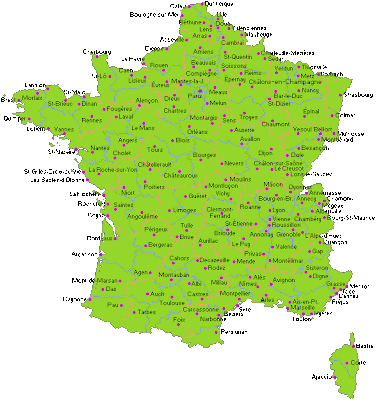
Find a useful map of France with cities below
France is a country in Western Europe, in fact the largest country in Western Europe. It has a total land area of 674,843 square km or 260,558 square miles, and a total population of 65,821,885 (including all overseas territories, which make up about 2.7 million of that total). The part of France located in Europe, excluding overseas territories, is referred to as Metropolitan France.
Metropolitan France is bordered to the southwest by Spain; to the southeast by Italy; to the east by Switzerland; and to the northeast by Germany, Luxemburg, and Belgium. The Principality of Monaco is also bordered by France on three sides, essentially making it an enclave within the borders of France.
The highest point in Western Europe is at Mont Blanc, situated in the French Alps at an elevation of 4,810.45 metres, or 15,782 ft. France extends over a number of climatic regions, with the southeast near Italy having a Mediterranean climate. The west of France has a temperate oceanic climate. The central inland areas have warmer summers and colder winters. And of course the alps region has an alpine mountain climate.


.png)

0 Comments