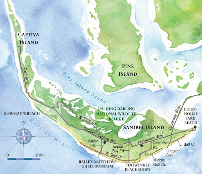
Below are some Sanibel Island maps to help you plan for your visits to the tiny but beautiful island.
Sannibel Island is situated in Flordia, off the Gulf coast near Fort Myers. It is a tiny island that consists of 33.16 square miles (or 85.9 km2 for Americans), and has a small local population of just over 6000. The entire island is incorporated as a city, called Sanibel.
The island retains its quiet and peaceful natural environment, in large part thanks to the Comprehensive Land Usage Plan, a conservation plan aimed at limiting development that would harm the island`s ecology. However, the old ferry that used to run between the mainland and the island has been replaced by a causeway. The first causeway featured a draw bridge, but a new higher bridge that runs uninterrupted is now functioning.
Sanibel Island is popular with tourists for its beaches and wildlife sanctuaries, including the "Ding" Darling National Wildlife Refuge. Like most of south Florida, the island has a humid subtropical climate that is hot and humid in summer, and mild and humid in winter.
Here is a Sanibel Island map that indicates where the main popular beaches are.


.png)

0 Comments