The Black Sea is a body of water surrounding by land in Europe, Anatolia, and the Caucasus regions. Even though it is an inland sea, it does have a connection to the Mediterranean Sea and Aegean Sea through some straits. Another strait connects it to the Sea of Azov. That strait is called the Strait of Kerch. The countries that border the sea are Bulgaria, Romania, Turkey, Georgia, Russia, and Ukraine. There is also the breakaway state of Abkhazia, which considers itself independent but most of the world considers part of Georgia.
Because of the Black Sea`s important location, right between a number of strategically, economically, and politically important areas, it was an important crossroads in ancient times. Archaeological evidence shows very early settlement and trade in the area. For example, the oldest processed gold in the world was found in the area.
The surface area of the Black Sea is 436,000 square km, or 168,500 square miles.
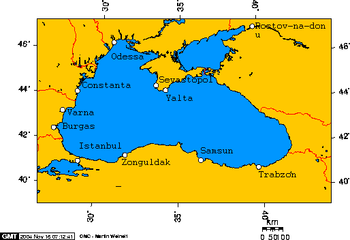
Below you may find a Black Sea map for your reference.


Because of the Black Sea`s important location, right between a number of strategically, economically, and politically important areas, it was an important crossroads in ancient times. Archaeological evidence shows very early settlement and trade in the area. For example, the oldest processed gold in the world was found in the area.
The surface area of the Black Sea is 436,000 square km, or 168,500 square miles.
Below you may find a Black Sea map for your reference.


.png)
0 Comments