Despite the legendary status and global name recognition of Miami, if we look at just the city population and exclude country and metro population, then the largest city in Florida is actually Jacksonville. It is the 11th largest city in all of the United States by population. It is also the largest city in the continental U.S. (measured by land area). Jacksonville itself has a population of 821,784 and its metro area has a total population of around 1.3 million. That is significantly smaller than Miami`s metro population. The reason Jacksonville is so large but its metro population is so much smaller than Miami, is that in 1968 Jacksonville City consolidated with the entire surrounding county, making most of the metro area all a part of a single city. Without that consolidation of local governments, Jacksonville would be much less populous than Miami.
Like much of Florida, Jacksonville has a humid subtropical climate, with hot summers and mild winters.
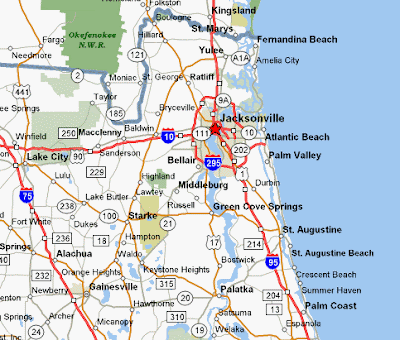
Below you can find a map of Jacksonville FL for your reference. Because of the sprawling size of the city, it`s hard to find a map that shows street level detail.


Like much of Florida, Jacksonville has a humid subtropical climate, with hot summers and mild winters.
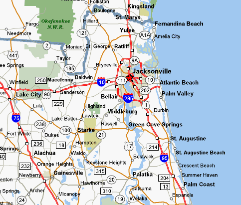
Below you can find a map of Jacksonville FL for your reference. Because of the sprawling size of the city, it`s hard to find a map that shows street level detail.


0 Comments