The country Philippines consists of thousands of islands, but the largest and most economically prominant island is Luzon. It is one of the three major areas of Philippines (the other two being Mindanao and the Visayas), and it is the island on which Manila is located, as well as Qezon City which is the most populous city in the Philippines. The island's population of over 46 million people makes it the fourth most populous island in the world.
Luzon has a land area of 104,688 square kilometers. Volcanic activity is ever-present on Luzon.
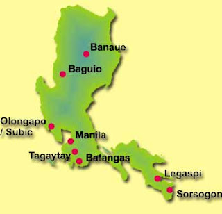
Below are some Luzon island maps to print and make use of.


I hope these printable maps of Luzon, Philippines will be useful to you. See you next time!
Luzon has a land area of 104,688 square kilometers. Volcanic activity is ever-present on Luzon.
Below are some Luzon island maps to print and make use of.


I hope these printable maps of Luzon, Philippines will be useful to you. See you next time!


.png)
0 Comments