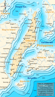
Cebu Island is one of the major islands of the Philippines. Along with some small peripheral islands, it forms Cebu Province. The island is also the central focal point and hub of the Visaya region of Philippines, with the provincial capital Cebu City serving as a major shipping port as well as port of ferry travel. To Cebu Island`s west lies Negoros island, and to its east lies Bohol and Leyte islands. Cebu is a long and narrow island, stretching 250 km from north to south, while being just 45 km wide.
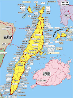
As is evident from the Cebu Island maps below, most of the population lives in the coastal areas of the island. This is because of the mountainous terrain of the central areas of the island. The island`s total area is 4,468 square km, with a population of 3.6 million. But if we look at only the inhabitable coastal plain, then the population density becomes clearer. Driving along the coast of Cebu you encounter an almost endless stream of towns and villages. And Metro Cebu is a busy urban area with a population of 2.3 million.
Below are some Cebu Island maps.


0 Comments