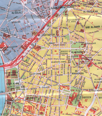
The Nile River runs through Cairo, with the city center lying on the east bank of the river. Giza and the Giza pyramids lie on the west bank of the river and require you to cross a bridge.
I have been to Cairo twice, and it is an exciting city. But it can be a little overwhelming because of its sheer size, population density, and chaos. I personally enjoy that kind of overwhelming chaos, because it's something I can't experience at home.
The downsides to Cairo are pollution (if you wear sandles, you will come to your hotel with very dirty feet, and when you blow your nose black soot will come out), and con artists. Be careful of scams, anywhere in the city center but especially around Midan Tahrir. Be wary of people who approach you in the street -- they always want something from you.
But Cairo makes an amazing travel destination if you can't keep your wits about you.
Below you can find a map of Cairo Egypt.


I hope you found a Cairo Egypt map that was useful for you. Enjoy your trip to North Africa!


.png)
0 Comments