If you`re looking around for a map of Bristol, England, then you won`t have to look any further than this page because...here they are! Bristol is both a city and a county in southern England, the sixth largest city in England and the eighth largest in all of the UK. Like many of the UK`s large towns, it is a port city. It was from here that many important voyages to the New World departed.
While import and export by sea used to be Bristol`s main economic activity, today it is active in the areas of media, information technology, defence, aerospace, and the financial services. Like many cities in the UK, it also has a fairly large tourist economy,
In terms of demographics, Bristol is 84% white (British-born whites making up 78%), while blacks comprise 6%, Asians 5.5%, 3.6% are mixed race, and around 1% are other.
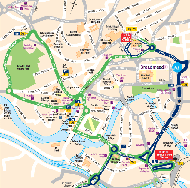
The first map is a great detailed one showing all the main streets, hotels, and attractions in downtown Bristol.
The next map of Bristol is a general one showing the neighbourhoods around the town.

This is my favorite Bristol map, showing all the main streets, neighbourhoods, and attractions downtown.

I hope you found what you were looking for up above! LIKE or SHARE if you found this page useful. It`s a big help for our website. :) Thanks!


0 Comments