Choose a map of Hawaii from those below.
 Having joined the Union on August 21, 1959, Hawaii is the newest state in the USA. It is entirely comprised of islands, making it unique amongst states in the country. And along with Alaska, it is one of the two non-contigous states, being separated from the mainland of the USA. It lies a whole 2000 miles (3200 km) southwest of the continental United States.
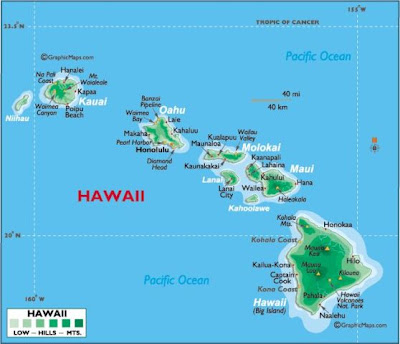
The archipelago that makes up the state of Hawaii consists of 8 main islands, namely Hawaiʻi, Maui, Oʻahu, Kahoʻolawe, Lanaʻi, Molokaʻi, Kauaʻi and Niʻihau, as well as countless other smaller islands. Its entire land area is 10,931 square miles (28,311 km2). The highest point in the state is Mount Kea, with an elevation of 13,803 feet (4207.3 meters). The state capital and largest city is Honolulu with 377,000 people, and around 953,000 in the city plus the surrounding county.
Below you can find a map of Hawaii for your reference.
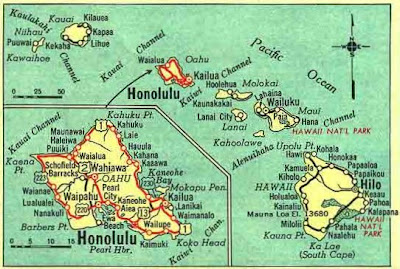
This is the oldest of the Hawaii maps here, but I included it because of the handy insert of Honolulu.


Hopefully you found the Hawaii maps above useful. Be sure to look at all our other categories and find what you`re looking for.
 Having joined the Union on August 21, 1959, Hawaii is the newest state in the USA. It is entirely comprised of islands, making it unique amongst states in the country. And along with Alaska, it is one of the two non-contigous states, being separated from the mainland of the USA. It lies a whole 2000 miles (3200 km) southwest of the continental United States.
 The archipelago that makes up the state of Hawaii consists of 8 main islands, namely Hawaiʻi, Maui, Oʻahu, Kahoʻolawe, Lanaʻi, Molokaʻi, Kauaʻi and Niʻihau, as well as countless other smaller islands. Its entire land area is 10,931 square miles (28,311 km2). The highest point in the state is Mount Kea, with an elevation of 13,803 feet (4207.3 meters). The state capital and largest city is Honolulu with 377,000 people, and around 953,000 in the city plus the surrounding county.
Below you can find a map of Hawaii for your reference.
This is the oldest of the Hawaii maps here, but I included it because of the handy insert of Honolulu.


Hopefully you found the Hawaii maps above useful. Be sure to look at all our other categories and find what you`re looking for.


0 Comments